Destination Profile
South India Motorcycle Tour — Ghats to Cape
India's Most Underrated Riding Region
Most riders planning India go north for altitude. South India does not have the pass records. What it has is smooth tarmac through 1,000 m of elevation change in 20 km, ghat roads that run without guardrails through forest and tea estate, and a climate window that works from October to March when the north is frozen.
The CraftedMoto version does not route through tourist-coach Munnar. We go through the interior Palani Hills, Kolli Malai's 72 hairpin bends — the most technically demanding mountain road in Tamil Nadu — and the Nilgiris backroads to Ooty. The frame is two riding personalities in one tour: Kerala's green mountain interior and Tamil Nadu's dry temple heartland, 150 km apart and completely unlike each other.
No altitude sickness risk. No gravel passes. The Kolli Hills and Kodai-Palani ghat roads demand real cornering technique. That is the challenge here, and it is a different kind of challenge from the north.
Why This Route?
The roads are the best in India for technical cornering. The culture contrast between Kerala and Tamil Nadu is sharper than anywhere else in the south. The season is October to March when the north is closed.
Expedition Stats
- Best Season: October – March
- Duration: 10–14 Days
- Difficulty: Intermediate (Kolli Hills: Advanced-Intermediate)
- Distance: ~1,400–1,800 km (870–1,118 miles)
- Max Altitude: 2,620 m (8,596 ft) at Ooty/Doddabetta. No AMS risk.
Route Spine — Kochi to Kanyakumari
Day 1: Kochi → Munnar (95 km / 59 miles, NH-85)
The Ghats climb begins at Adimali — tea plantations at road level from here onwards. This is the warmup day. The road comes in at 2,100 m (6,890 ft) by the time you reach Munnar town. Rapsy Restaurant on AM Road is open from 7am: Kerala parotta, the local flatbread cooked on a tawa, black tea. Rider staple for the region.
Day 2: Munnar → Thekkady/Kumily (85 km / 53 miles, SH-77)
Cardamom farm roads and spice estate gates on both sides. SH-77 runs through the Periyar Tiger Reserve buffer zone — single lane, almost no traffic, cardamom smell in the air from the estates. Fill fuel at Kumily before continuing. No petrol between Kumily and Upper Kodai, 40 km of mountain road ahead.
Day 3: Thekkady → Kodaikanal (140 km / 87 miles) — The Day Riders Remember
Cross into Tamil Nadu and climb the Palani Hills to Kodaikanal at 2,200 m (7,218 ft). The Kodai-Palani ghat road has 40 hairpin bends. Start by 7am — clouds roll in across the valley by 11am and the road disappears into mist. I got the last 8 bends in clear light on the last run before cloud cover dropped. Riders who leave at 9am get fog from bend 30 onwards. The descent into spice-village territory on the far side is a different road entirely.
Day 4: Kodaikanal → Madurai (120 km / 75 miles)
The descent through spice villages drops the temperature noticeably by the time you hit the plains. Arrive evening. Meenakshi Amman Temple on foot — the 14 gopurams (towers) are each covered in thousands of individual painted figures. The south tower is 52 m (171 ft). This temple has been continuously operating for over 1,500 years. Murugan Idli Shop on Town Hall Road: filter coffee and idli from 6am the following morning, eaten standing.
Day 5: Madurai → Rameshwaram (170 km / 106 miles)
Long coastal flat through Ramanathapuram. The Pamban Bridge arrives without ceremony at the end of the causeway — 2.3 km of open sea on both sides, the rail bridge running alongside. Cross at sunrise: 6:30am light on the Palk Strait is specific to this crossing and worth the early departure from Madurai. Rameshwaram island fish curry-rice for lunch — walk one lane in from the main street, any hotel dining room.
Day 6: Dhanushkodi Spur (18 km / 11 miles from Rameshwaram)
Fill to full at Rameshwaram town — no fuel on the spur. The first 14 km is tarmac. The road ends in sand for the last 4 km. Dhanushkodi is a ghost town abandoned after a 1964 cyclone that killed over 1,800 people — the ruins of the railway station, church, and post office are completely intact and unused. India's last mainland point. The sand here is coarser than Sam dunes. The ride back on the sand track in afternoon light is the kind of thing riders describe later without any frame of reference to compare it to.
Day 7: Rameshwaram → Kanyakumari (300 km / 186 miles)
Coastal Tamil Nadu. Tirunelveli for dinner — Krishnavilas restaurant for Tirunelveli halwa, a wheat halwa soaked in ghee that has been made in this town for over 200 years. Buy a box for the road. Arrive Kanyakumari at dusk where the Bay of Bengal, Arabian Sea, and Indian Ocean converge at the cape.
Days 8–9: Kanyakumari → Varkala (150 km / 93 miles) — Kerala Return
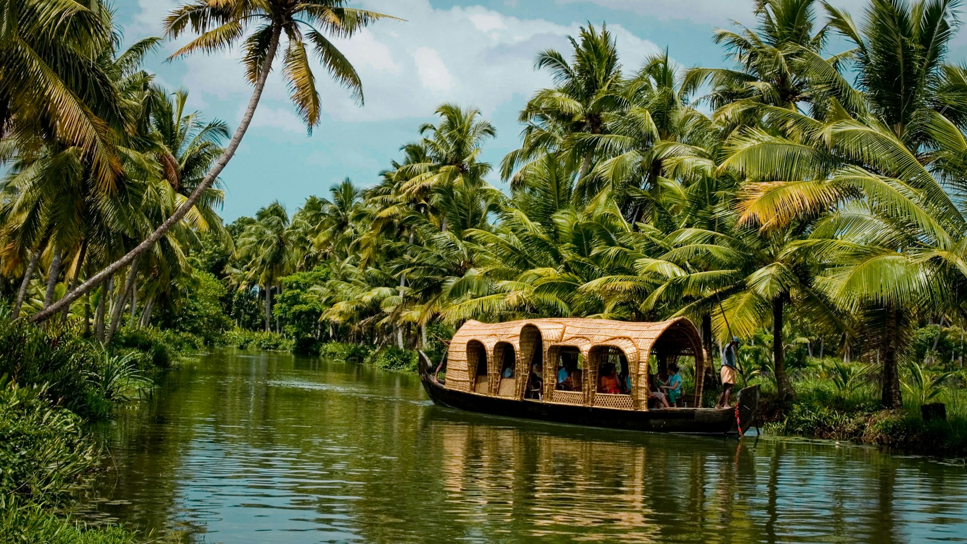
Re-enter Kerala. Varkala's cliff road runs along the laterite edge above the beach, 30 m (98 ft) above sea level, with the cliff visible on the right for 2 km. Optional extension: Alleppey backwaters houseboat stay then Fort Kochi finish, 75 km further.
Rider-Specific Roads
Kolli Hills / Kolli Malai — 72 Hairpins to 1,300 m (4,265 ft)
No tourist traffic. The most technically demanding mountain road in Tamil Nadu. Base at Namakkal, 60 km (37 miles) away — fill there, no petrol on the climb. The bends are tight, consistent, and surfaced throughout.
Kodai-Palani Ghat Road — 40 Hairpins, Misty Forest
Almost no traffic. Cloud cover drops from the valley by 11am. Depart Kodaikanal by 7am for the descent in clear light. The upper bends face west into the valley — the morning is the only window with full visibility.
Valparai — 64 Hairpins Through Tea and Coffee Estate
Approaches from Pollachi through Anamalai forest corridors. Lion-tailed macaque sightings on the road are common in the morning. Almost no other riders come here. The estate roads above Valparai are a separate riding section of 15–20 km through working plantation.
Munnar-Marayur Road (SH-17)
55 km (34 miles) of empty road through Chinnar Wildlife Sanctuary buffer and sandalwood forest. No tourist traffic. The sandalwood plantation smell is noticeable from the saddle for about 8 km of this stretch.
Pamban Bridge, Rameshwaram
2.3 km over the Palk Strait. Open water both sides at road level. Only place in India where you ride across open sea on both sides simultaneously. Cross at sunrise.
Fuel Gaps to Know
- Thekkady → Kodaikanal: Fill at Kumily. No petrol between Kumily and Upper Kodai — 40 km mountain section.
- Rameshwaram → Dhanushkodi: Fill in Rameshwaram town. No fuel on the 18 km spur.
- Kolli Hills: Fill at Namakkal, 60 km (37 miles) from the base. No petrol on the 72-bend climb.
Where We Stay
- Munnar: Blackberry Hills above the tourist strip. Mechanic referrals available through the guesthouse. Eastend Hotel if mid-range is the preference.
- Kodaikanal: Elephant Valley Resort, 20 km from town in a coffee plantation. No crowd. Quiet enough to hear the forest at night.
- Madurai: Hotel Park Plaza near the temple. Walk to Meenakshi in 10 minutes. Secure bike parking inside the property.
- Kanyakumari: Hotel Tamil Nadu (TTDC) government property on the cape. Balcony faces the three-sea confluence directly.
- Varkala: Cliff-road guesthouses above the beach — laterite construction, open-air dining.
Best Season
| Window | Conditions | Verdict |
|---|---|---|
| Oct–Feb | Coast 25–32°C (77–90°F), hills 12–18°C (54–64°F). No rain on the west coast. | Best window |
| Mar–May | Plains heat up to 38–42°C (100–108°F). Hill stations still pleasant. | Hill-route only |
| Jun–Sep | Southwest monsoon hits Kerala and Western Ghats hard. Ghat road landslides common. | Not recommended |
Terrain and Difficulty
Road Surface
75% smooth tarmac highway and ghat road. 15% tight hairpin bends (Kodai-Palani, Kolli Hills, Valparai). 10% sand at Dhanushkodi only. No gravel or off-road required.
Altitude
Maximum 2,620 m (8,596 ft) at Ooty/Doddabetta. No acclimatization needed. No AMS risk on any South India route.
Skill Level
Intermediate. Ghat hairpin technique required throughout. Kolli Hills (72 bends) is advanced-intermediate. Coast and temple sections are accessible to confident beginners.
Distance
~1,400–1,800 km (870–1,118 miles) over 10–14 days depending on route depth. Kochi to Kanyakumari core is ~1,100 km (684 miles) over 10 days.
What's Covered
- Royal Enfield Himalayan 450 or Meteor 350
- Expert Mechanic & 4x4 Support Vehicle
- All Fuel Costs
- Heritage Guesthouses & Plantation Stays
- Pamban Bridge & Dhanushkodi Spur Access
- Custom Route Based on Skill Level
Frequently Asked Questions
Is South India suitable for experienced motorcycle riders?
Yes. The Kolli Hills 72-hairpin climb, Kodai-Palani ghat with 40 bends, and Valparai's 64-hairpin road all require precise ghat technique. The roads are smooth tarmac throughout. The challenge here is cornering, not survival — which makes it technically interesting rather than physically punishing.
What is the best season for South India motorcycle touring?
October to February. Coast temperatures run 25–32°C (77–90°F), hill stations 12–18°C (54–64°F), zero rain on the west coast. June to September brings the southwest monsoon into Kerala and the Ghats. Ghat road landslides are common in that window.
What is the Pamban Bridge ride like?
The Pamban Bridge runs 2.3 km across the Palk Strait to Rameshwaram island with open sea on both sides. Cross at sunrise — 6:30am light on the water is specific to this crossing and does not repeat at any other time of day.
What is the Dhanushkodi road like?
18 km from Rameshwaram. Tarmac for the first 14 km, sand track for the last 4 km to the ghost town ruins. Fill fuel at Rameshwaram — no petrol on the spur.
How many days does the South India tour take?
The Kochi to Kanyakumari core route covers roughly 1,100 km (684 miles) in 10–12 days. Adding Kolli Hills and the Varkala coastal return brings the total to 1,400–1,800 km (870–1,118 miles) over 12–14 days.
For riders extending south to the coast before arriving in Kerala, the Konkan coast expedition from Mumbai to Goa links directly to the northern Kerala entry point. To plan your South India motorcycle expedition, contact us with your October–March window.
— Route, fuel, and seasonal details verified by expedition team.
Plan Your South India Expedition
October to February fills quickly for the Kolli Hills and Kodai-Palani ghat windows. Contact us to check availability for your dates.
Plan Your South India Expedition