Spiti Valley Road Open Dates
Last updated:
TL;DR — Key Takeaways
- The Shimla–Kaza route (NH-505 via Kinnaur) is open year-round except brief landslide/snow closures near Nako. This is the only way in before the Manali route opens.
- Kunzum La (4,551 m / 14,931 ft) is the gating point on the Manali side. It typically opens late May to early June.
- In 2025, Kunzum La opened 24 May — slightly early. In 2024, it opened in the first week of June. In 2022, it opened 3 May, which is the earliest on record.
- "Open" for the first 2–3 weeks usually means 4×4 vehicles only. Motorcycles follow roughly two weeks after first vehicle clearance.
- The Losar–Batal water crossings peak after midday. Cross before 8 AM or get stopped.
- If Kunzum La closes while you're inside Spiti, you exit via Shimla — that adds ~380 km (236 miles) and a full day.
The Two Routes In and Their Completely Different Rules
This article is for riders planning the Spiti circuit from the US, UK, Europe, or Australia — people booking flights 3–6 months out and needing to understand what "open" and "closed" actually mean before committing to dates. If you are still deciding whether Spiti is the right expedition, start with our Spiti Valley motorcycle tour overview first, then come back here for the dates detail.
Start here: there is no single answer to "when does Spiti open?" because there are two entirely separate routes in, and they operate on different calendars.
Route 1 — Shimla to Kaza via Kinnaur (NH-505)
This road follows the Sutlej and Spiti river valleys. It does not cross any high pass. The highest point on the paved surface is around 3,800 m (12,500 ft) near Nako. It can be temporarily blocked by landslides or heavy snowfall near Malling Nallah, but there is no seasonal closure. Riders who travel this route in February are cold, not blocked. We've done the Shimla approach in October with ice on the road before Tabo, and the surface was rough but passable. This route does not have a fixed open date.
Route 2 — Manali to Kaza via Kunzum La
This route crosses two passes. With the Atal Tunnel (opened October 2020), you now bypass Rohtang La entirely. The Atal Tunnel is 9 km (5.6 miles) long, sits at 3,048 m (10,000 ft), and is open year-round. The bottleneck is what comes after — the road from Gramphu through Batal to Kunzum La and down to Losar. This 120 km (75-mile) stretch is buried under 3 to 6 m (10 to 20 ft) of snow from late October through May. BRO clears it from both ends simultaneously. Until Kunzum La is clear and connected all the way through to Losar, the route is closed. The Border Roads Organisation (BRO) posts clearance updates through official channels as each section opens.
Pass-by-Pass Opening Dates: 5-Year Historical Table
This table covers the Manali side. The Shimla side has no fixed dates.
| Pass / Section | 2021 | 2022 | 2023 | 2024 | 2025 | 2026 (expected) |
|---|---|---|---|---|---|---|
| Kunzum La (4,551 m / 14,931 ft) | Late May | 3 May *(record)* | Late May | Early Jun | 24 May | Mid May–Early Jun |
| Gramphu–Batal stretch | ~Same as Kunzum | ~Same | ~Same | ~Same | ~Same | ~Same |
| Chandratal lake road (diversion) | ~10 Jun | ~20 May | ~Late May | ~10 Jun | ~Early Jun | ~Early–Mid Jun |
| Losar–Kaza internal roads | Apr–May | Apr | Apr | Apr–May | Apr | Apr |
| Route closes (autumn) | Mid Oct | Mid Oct | Mid Oct | Mid Oct | Mid Oct | Mid Oct |
Notes on the table:
- 2022 was an outlier driven by low winter snowfall and unusually warm April weather. Do not plan around it repeating.
- "Open" in the first weeks means 4×4 and SUVs only. Motorcycles are typically cleared 10–14 days after first vehicle passage, once the surface has been tracked and compacted.
- Chandratal lake road is a separate 14 km (8.7-mile) diversion off the main pass road. It opens 2 to 3 weeks after Kunzum La and has no camping infrastructure until mid-June.
- The Atal Tunnel has removed the Rohtang permit requirement entirely for riders coming from Manali. You do not need a Rohtang Pass permit if you use the tunnel.
What "Open" Actually Means — and What It Doesn't
Every rider planning a June departure needs to understand this distinction. When BRO announces Kunzum La is open, they mean:
- A single vehicle-width channel has been cut through the snow
- The road surface is freshly cleared gravel and compacted snow
- There may be 2 to 4 m snow walls on both sides of the road at the pass summit
- Rocks, debris, and ice patches are present on the descent toward Batal
What it does not mean:
- The surface is stable or predictable
- The water crossings on the Gramphu–Batal section are passable without wading
- Motorcycles are officially permitted (check current BRO advisories)
- The road is safe after 10 AM when glacier melt peaks
We rode Kunzum La on 6 June 2023 in the first week of opening. The pass itself was clear. But on the Batal side, the descent dropped us onto a section of mud and loose shale for 4 km where the snow had melted the day before and turned the road into a brown porridge. We walked the bikes through it one at a time at about 5 kmph. That is what early-season looks like.
The Shimla Side: Year-Round With One Real Exception
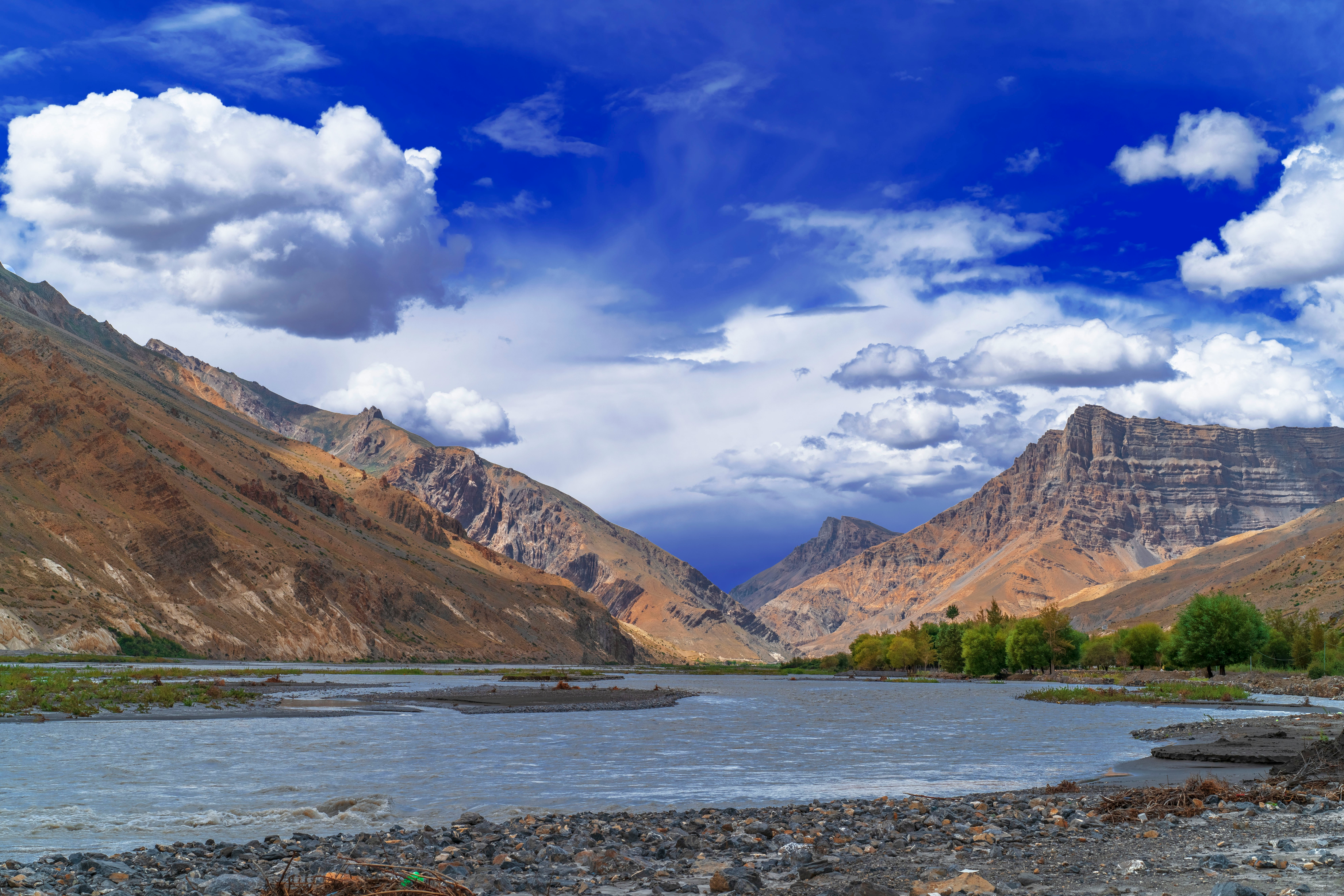
The Shimla–Kaza route is 430 km (267 miles) from Shimla to Kaza. It runs through Rampur, Reckong Peo, Nako, Tabo, and follows the Spiti River through the valley floor. At no point does it cross a pass above 4,000 m (13,100 ft).
The stretch that trips riders up is Malling Nallah, near Nako at around 3,622 m (11,883 ft). This is a narrow section between vertical rock walls where the road runs through a water channel that floods during heavy snowmelt and monsoon rain. In February 2024, it was closed for 11 days due to ice fall. In September, it was running fine when we came through northbound. If there is one place on the Shimla side to check before departure, it is here. The Himachal Pradesh Tourism Department publishes seasonal road advisories that include the NH-505 corridor through Kinnaur.
Fuel situation: last reliable fuel is in Reckong Peo. After that, there is a fuel point in Nako (quality variable — carry a jerry can) and then Kaza, 180 km (112 miles) later. On a Himalayan 450 with a 17-litre tank, you can make it comfortably if you fill completely in Reckong Peo. On the 411, same story — fill there, do not rely on Nako. Full tank capacity and range specs for both platforms are on the Royal Enfield Himalayan official page.
The Water Crossings Between Losar and Batal

This section matters more than any date. You can arrive in perfect weather on a day when Kunzum La is technically open, and still not make it through Batal if you start late.
The Gramphu–Batal section has 42 identified water crossings in a 60 km (37-mile) stretch. Most of these are manageable in the morning. After noon, glacier melt raises flow levels to the point where some crossings become impassable for motorcycles. The crossings at Chota Dhara (locally called Chhota Dara) are the worst — a fast-moving stream across the road at the base of a rocky descent where you cannot see the depth from the saddle. We've watched loaded Himalayans get pushed sideways here at 2 PM. Same crossing at 6:30 AM is shin-deep, slow water.
The rule is binary: start before 7 AM from Batal if going toward Manali, or from Gramphu if going toward Kaza. If you start at 8 AM, you will hit the crossings at 10 AM when they are still manageable. If you start at 10 AM, you will reach Chota Dhara around noon in heavy afternoon melt. There is no compromise on this timing in June and July.
The Losar–Batal crossing that riders specifically ask about typically opens approximately 2 weeks after Kunzum La, because the snow on the valley floor between Losar and Batal melts later than the pass summit. Even when Kunzum La is declared open, the road between Losar and Batal at the 14 km marker from Losar changes from tarmac to loose river rock — and stays that way until the first week of June in most years.
What Happens If Kunzum La Closes While You're Inside Spiti
This is not a theoretical question. Unseasonable snowfall in late September or early October can close Kunzum La in 48 hours. In 2019, a group of 8 riders was inside Spiti when an early snowfall closed the pass on 8 October. They had planned the Manali exit. They exited via Shimla instead — adding 380 km (236 miles), one extra riding day, and a complete re-routing of their return logistics.
Your contingency plan if Kunzum La closes while you are in Spiti:
- Exit via Shimla–Kinnaur. From Kaza, it is ~430 km (267 miles) to Shimla. In good conditions, 2 days. Road is year-round, no pass above 4,000 m.
- Wait it out in Kaza. If it is a brief weather event (24–48 hours), the pass often re-opens. Kaza has guesthouses, one petrol pump on the main road near the bus stand, and BSNL mobile coverage.
- Call BRO directly. The Lahaul and Spiti district road status line is the primary authority. Your local guesthouse in Kaza will have the current number — it changes seasonally.
Do not attempt to push through Kunzum La in fresh snow on a motorcycle. Three riders have died on that pass in the last 10 years — all in early or late-season snow conditions.
Planning Calendar for US and UK Riders
Most riders flying in from the US, UK, or Europe are booking 4 to 6 months ahead. Here is the window logic:
June (mid-month to end of June)
Both routes fully open. Water crossings are active on the Manali side — manageable with early starts. Fewer riders than July. Chandratal camping operational from mid-June. Cold nights — 2°C to 5°C at Kunzum La even in June. Daytime at Kaza hits 18°C to 22°C (64°F to 72°F).
July and August
Both routes open. Higher rider traffic. Monsoon does not directly affect Spiti Valley (the Great Himalayan Range blocks most rain), but the Kinnaur section of the Shimla route can have landslides from July rain hitting the lower slopes near Rampur. The Gramphu–Batal water crossings are at their most aggressive in July — crossable with correct timing, but not casual. Peak season for accommodation.
September
Best riding month. Both routes open. Water crossings calm down as temperatures drop. Fewer riders than August. Chandratal before 7 AM in September is one of the clearest lake views we have seen. Night temperatures start dropping hard at the end of September — be prepared for below-zero nights at altitude after 20 September. Riders who want to combine Spiti with Ladakh in a single trip often use September for this — see how we structure the Ladakh motorcycle expedition around that window.
October (first two weeks)
Still open, but weather is rolling dice. The pass can close on any day after 10 October. We have ridden it in the second week of October twice — both times fine. We have also had guests call us from Kaza in the second week of October after the pass closed on them. If you plan October, know your Shimla exit.
FAQ
Does Spiti Valley road open on the same date every year?
No. Kunzum La has opened anywhere from 3 May (2022, record) to the second week of June (bad snow years). The consistent window is late May to early June for the Manali side. The Shimla side has no fixed open date — it is available year-round.
Which side opens first — Shimla or Manali?
Shimla is always accessible because it does not cross a high seasonal pass. The Manali side opens when Kunzum La clears, which is typically late May to early June. Kunzum La from the Kaza (Losar) side clears before the Manali (Gramphu) side because the Manali side has heavier snowfall and passes through avalanche zones. This means you can sometimes drive from Kaza to the top of Kunzum La and back before the Manali side is connected.
Can motorcycles cross Kunzum La before it officially opens for all vehicles?
No, and attempting it is genuinely dangerous. When BRO first clears the pass, they restrict it to 4×4 vehicles with high ground clearance. The surface at first opening has ice sheets, compacted snow, and exposed rocks that are unpredictable under loaded motorcycle tyres. We have seen riders make the argument that a Himalayan is lighter and more nimble — it is, but it is also harder to control a rear slide at 14,931 ft (4,551 m) when there is no guardrail and a 300 m drop to the east side. Wait for the official motorcycle clearance, which is 10 to 14 days after first vehicle passage.
What happens if Kunzum La closes while I am in Spiti?
Exit via the Shimla–Kinnaur route. From Kaza to Shimla is 430 km (267 miles) on a year-round road with no pass above 4,000 m. Plan for two riding days. Guesthouses are available in Tabo, Nako, and Kalpa along the route.
A Note on "Checking Before You Go"
Every article about Spiti tells you to check road status before departure. Most do not tell you where to check or what the output actually looks like. The two sources that matter:
- Lahaul and Spiti District official road status — the Lahaul and Spiti district portal is the authoritative source. Updated irregularly but the only official line-by-line pass status. Your Kaza guesthouse will have the direct phone number — it changes seasonally.
- BRO GREF WhatsApp updates — BRO's Project Shivalik posts road status updates. Ask your India contact or expedition operator for the current group link.
Rider forums such as ADVrider and local Facebook groups (Spiti Valley Travel and Riders Group) aggregate real-time reports from riders who crossed yesterday. These are the fastest source for current conditions but not authoritative for pass status. For permit questions and what to carry, our India motorcycle tour FAQ covers the logistics that sit alongside the road dates.
We update this post every March when BRO confirms the current-season clearance schedule. Last updated: March 2026.
Planning a Spiti ride? Tell us your dates and we'll build the route around actual open conditions, not generic calendar advice.